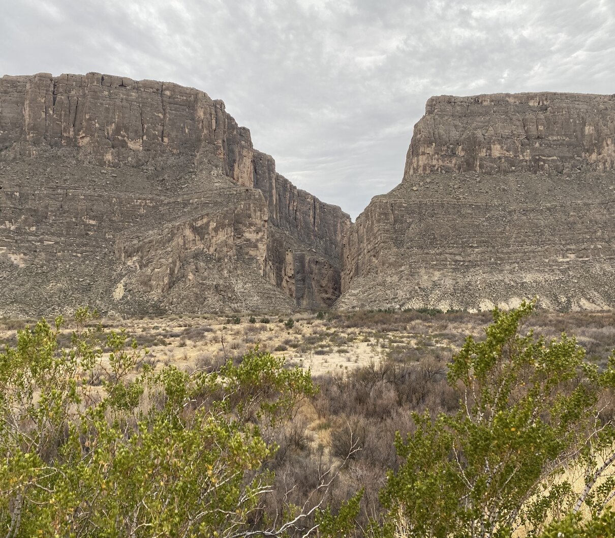
Big Bend is massive; it is over 1,250 mi² of Chihuahua desert in South West Texas.
There are three main visitor’s areas. The Chisos Basin at the top of the Chisos Mountains, Rio Grande Village at the south east boarder with Mexico and the Santa Elena Canyon at the south west corner of the park.
Hiking abounds throughout the park with the most accessible trails beginning at the Chisos Basin. As it is the least arid part of the park, and has great views of the desert, it was the most popular area.
We took two separate hikes from the basin, the Chisos Basin Loop Trail (2 mi/ 3.1 km) and the Lost Mine trail (4.6 mi/7.7 km). Both hikes were enjoyable for the views and neither hike was difficult.
The Santa Elena Canyon Trail is the park’s real beauty. Although we were there on an overcast day, the canyon is still something to behold. The 30 mile drive takes you from a flat plain into small hills, sections of the road that flood in the rainy season and towards a 1500 foot tall wall of rock. If the wall was white you could imagine that you were visiting a scene in Game of Thrones. It is intimidating and regal at the same time. It hardly looks real.

The Rio Grande has cut a narrow canyon into this tens-of-miles long limestone wall that rises over the desert floor. Although the trail is listed as 1.6 mi / 2.6 km, there is a significant elevation gain as you cross the river to get to the canyon. The riskiest part was the unofficial access to the main trail due to some unexpected water at its start. We had to scramble up and down some steep pitches and narrow ledges to get to the concrete steps leading up into the canyon. This part had its challenges, as well, in that there were no railings on the tight switchbacks. Phyllis could only look down at her feet until she was on a more substantial base.
There was a section after the steep climb that reminded us of hiking into a box canyon at the north end of Zion in the Kolob Canyons. Once we reached flowing water, and a very large chunk of fallen rock, we could appreciate the how the water formed the canyon. When the water levels in the Rio Grande are higher, it is possible to kayak down the river.
Beyond these areas, the park is mostly desert although there are numerous small tenting areas and a few larger campgrounds. The overall development in the park was a bit disappointing. Considering the size of the park, and its great potential for physical activities and public education, the camping areas were not as spacious or well supported as a BC park, for example. The visitors’ centres were lacklustre.

We enjoyed Castolon on the way to Santa Elena Canyon. At one time it was an army outpost, which then became a cross border settlement with a cotton industry and farming community. Unfortunately, the previous outpost building was destroyed in a fire that jumped the Rio Grande in 2019. Restoration efforts are underway and the remaining historical buildings and story boards illustrated the isolated life of the inhabitants quite well.

We chose to camp near Alpine TX, about an hour and a half from the park and because of the narrow, hilly, twisted roads and are glad we did. It would have been a chore to drag the trailer into the park. We came across an article about the Ten Best Small Towns in the Big Bend Area. Though we visited five of them, none of them caught our fancy.

That old steam engine is cool.
It was used in an attempt to grow cotton in the desert. Unfortunately, over time, that was a futile task.
You had me at Chihuahua! Lol.
Spectacular area guys! Thanks for sharing.